The address tab allows users to enter two types of address information.
The Location area is used to identify the physical location of the church. The most important fields for the location are the GPS coordinates. X is latitude, Y is longitude. If the exact GPS coordinates are not know, Harvest will randomly assign a XY coordinates using the administrative boundaries provided by the user. In this case the church location will be accurate to the lowest administrative level entered. The XY coordinate will be placed somewhere within that administrative boundary.
If possible the accurate physical location of the church should be entered using the coordinates from a GPS device. Most smart phone and tablets have a GPS receiver built in to them.
If the coordinates are accurate the Accurate Coordinates field should be checked so when the church is displayed on a map users can be confident of the churches physical location.
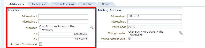
The second address field is for the mailing address. Often this is different from the physical location. For example when church uses a PO Box for their mailing address.
By default the Mailing Address Valid fields is checked. If a letter is returned this field can be unchecked so that mailing labels will not be printed using this address.
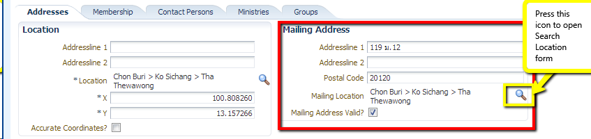
When entering address information user must press magnifying glass icon to enter the location information. This will show the Search Location pop-up
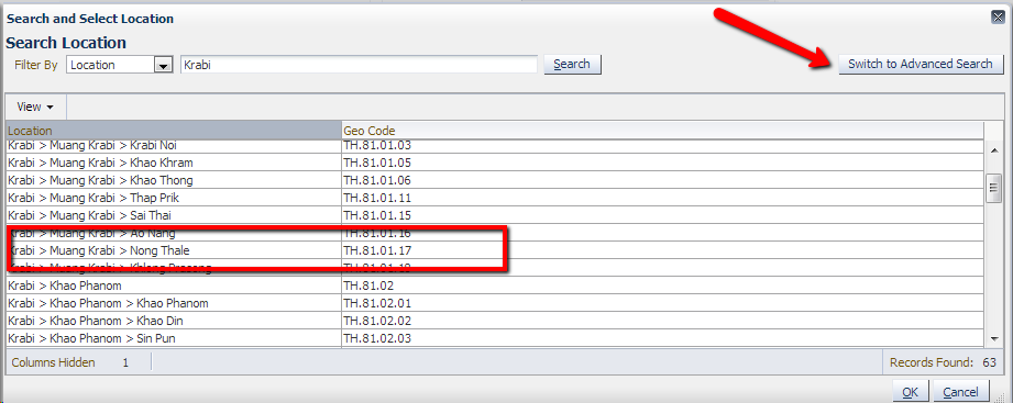
In this pop-up the user can enter the province or another administrative division and then select the correct location for the church.
The Switch to Advanced Search button allows the user to choose the location in the second language or enter the Geo Code (HASC Code) directly